Day 01 / Points / Dartmoor
Dartmoor by starlight
Which hills stand out from the ground around them, rather than simply standing high?
 Enlarge
Credits: Database of British and Irish Hills (CC BY 4.0); Natural England, Ordnance Survey (OGL v3.0). Full sources
The thinking
What changed and why
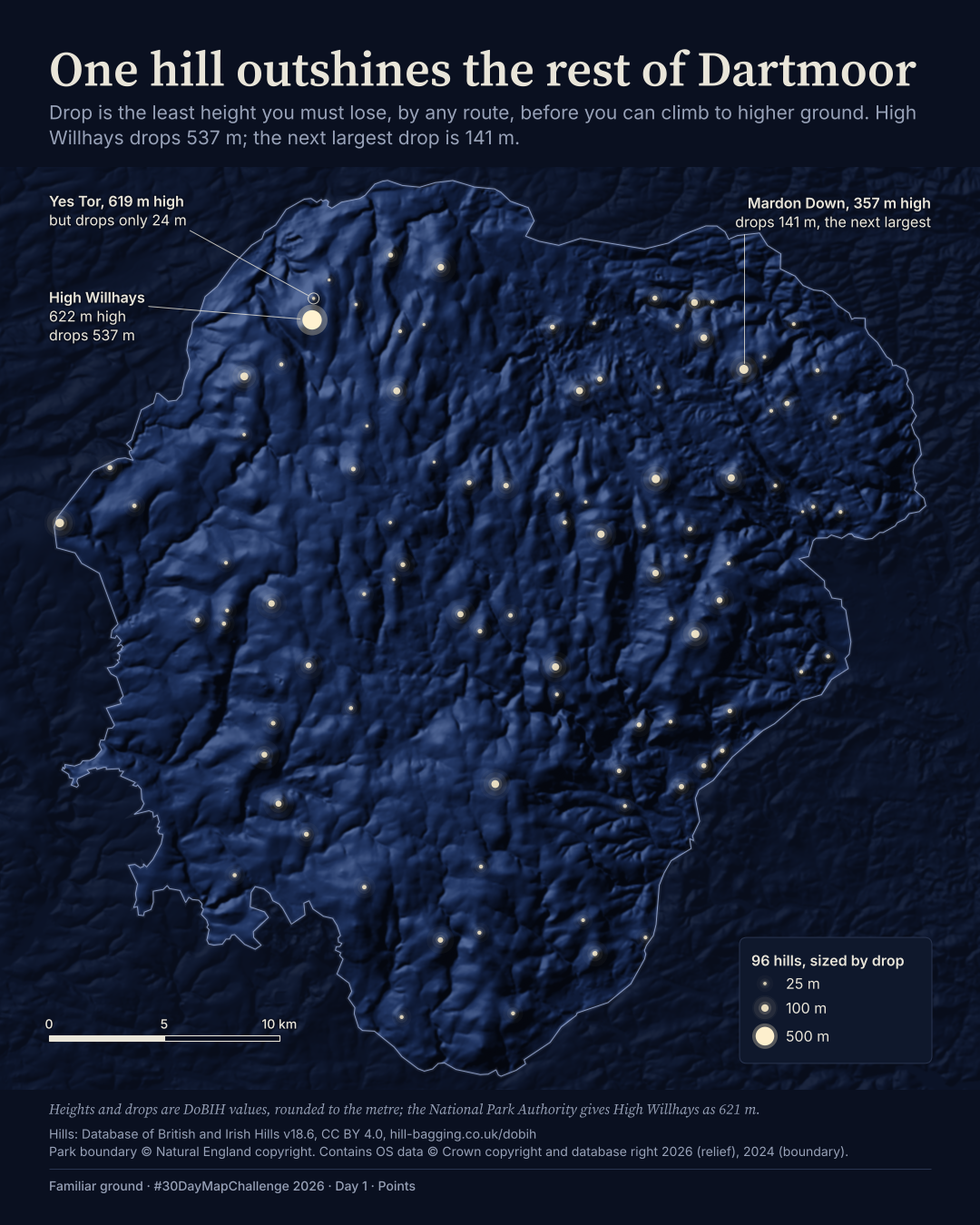
I kept the night ground here because the stars are the idea, but added shaded relief so they sit on recognisable slopes.
I removed the height colours, tor rings and water. One size key and three callouts now explain drop: the least height you must lose before climbing to higher ground.
I made the finding the headline. High Willhays drops 537 m; the next largest drop among these 96 hills is 141 m. In the film, the hills appear in order of drop, with High Willhays last.
Before / after
A second look
Same canvas, different decisions. Drag the divider, or focus the slider and use the arrow keys. This compares layouts, not perfectly registered geography.
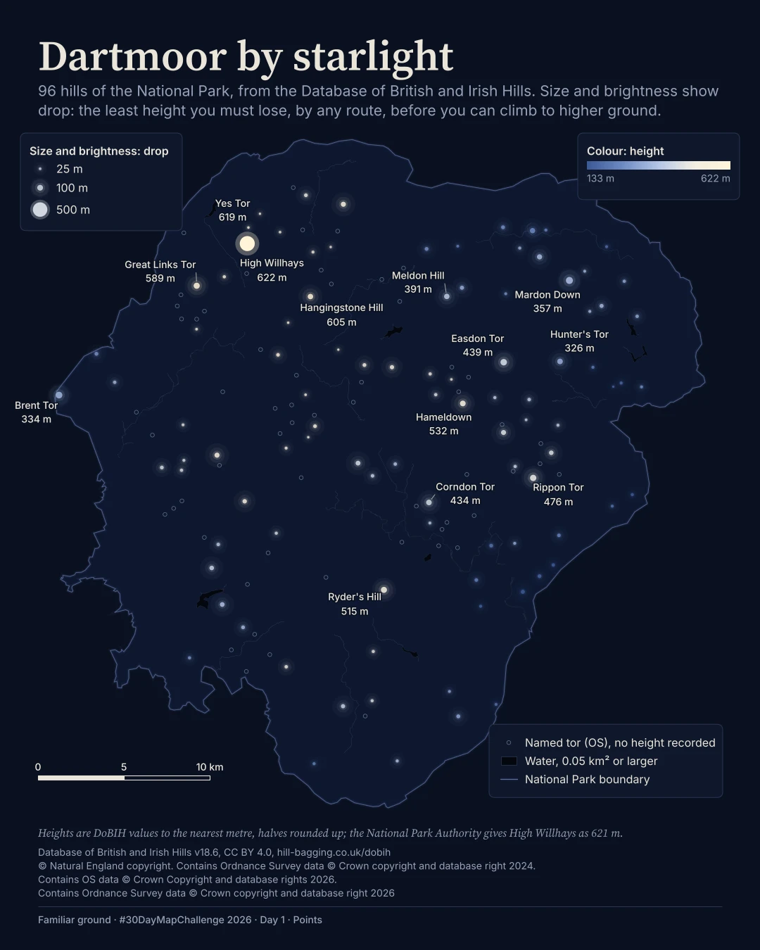
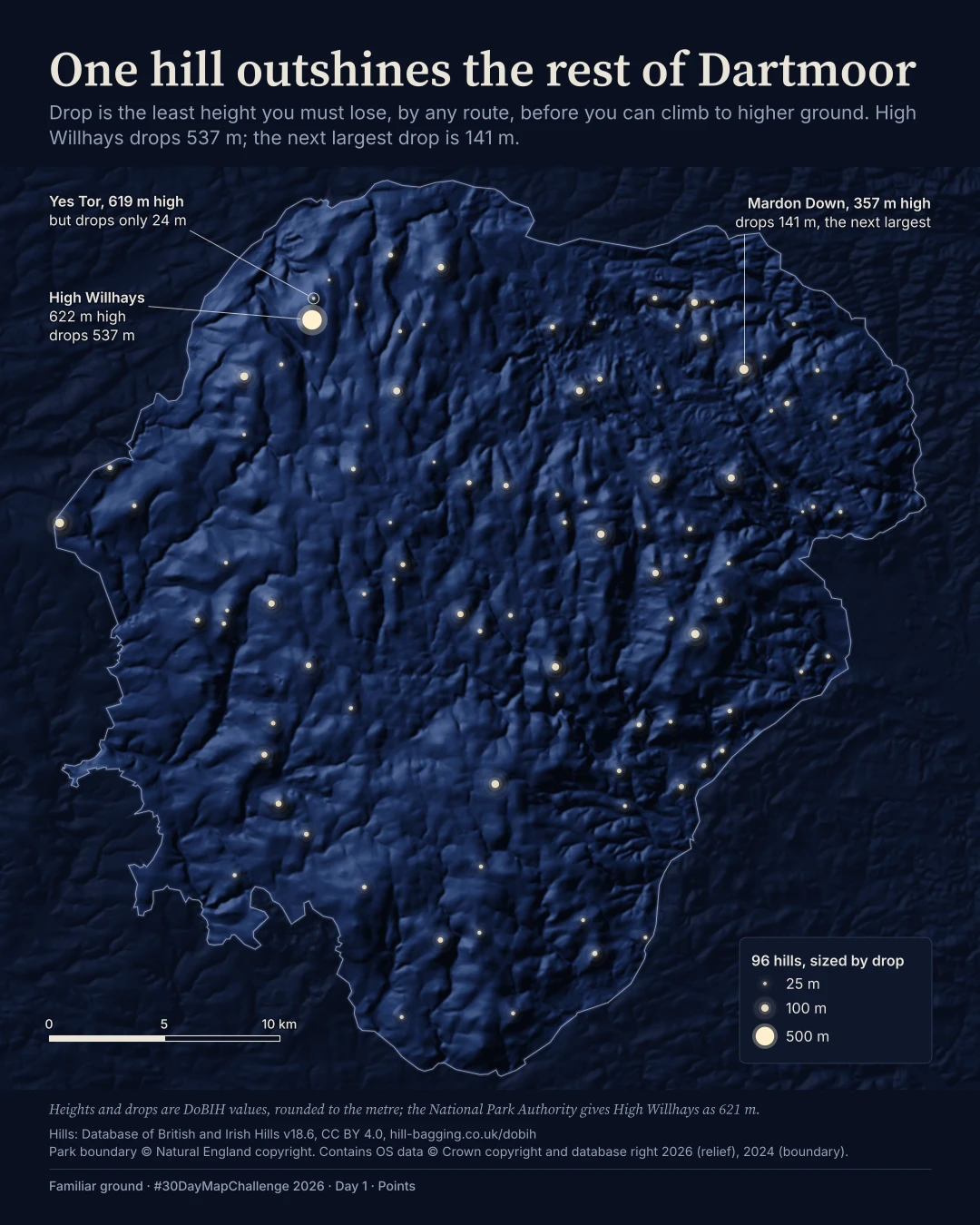
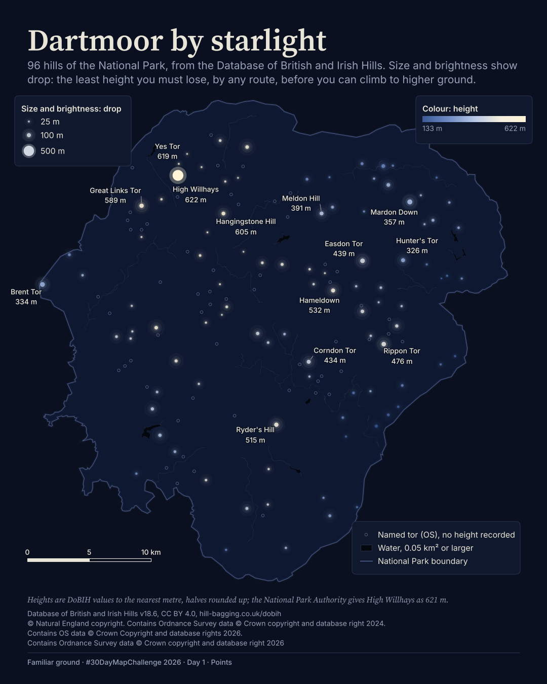
Plate 01 in motion
The film
BThe map in motion
I made the finding the headline. High Willhays drops 537 m; the next largest drop among these 96 hills is 141 m. In the film, the hills appear in order of drop, with High Willhays last.
Text description of this film
Dartmoor's 96 hills as pale stars over moonlit relief. Star size shows drop, not height. High Willhays dominates with 537 m of drop; Yes Tor drops 24 m despite being almost as high. Three callouts replace the original thirteen labels.
Method
How it was made
I filtered the Database of British and Irish Hills to the park boundary and sized the stars by drop on a gentler-than-proportional curve. For B, I shaded a 50 m terrain model beneath them. The three callouts are placed by hand; the hill measurements did not change between versions.
Limits
What this cannot tell you
These are database hills, not a complete survey of tors. The database gives High Willhays a height of 622 m; the National Park Authority gives 621 m. I use the database value, not the terrain model's maximum.
Next
What I’d do next
I would build water and symbol exclusion rules into label placement from the start, use separate distances for name matching and duplicate summits, and check the result on a real phone in daylight.
Read my learning logData and credits
Sources
I filtered the hills and boundary, matched tor names for A, clipped the water, and shaded and re-symbolised the relief for B.
- Hills · A and B
- Database of British and Irish Hills v18.6, CC BY 4.0, hill-bagging.co.uk/dobihCC BY 4.0
- Park boundary · A and B
- © Natural England copyright. Contains Ordnance Survey data © Crown copyright and database right 2024.Open Government Licence v3.0
- Tor names · A only
- Contains OS data © Crown Copyright and database rights 2026.Open Government Licence v3.0
- Water · A only
- Contains Ordnance Survey data © Crown copyright and database right 2026Open Government Licence v3.0
- OS Terrain 50 relief · B only
- Contains OS data © Crown copyright and database right 2026Open Government Licence v3.0
My map design and text: Creative Commons Attribution 4.0 (CC BY 4.0). Source data retain the licences above. Every source across the series is on the credits page.