Familiar ground / Index of plates
The index.
Every map in the series so far, numbered by its challenge day and pinned to the place it asks about. 10 plates, one new question each.
- 01
 Posted
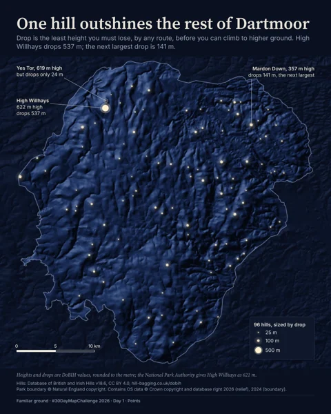
Dartmoor by starlight
Dartmoor · Points · 2 maps, film
- 02
 Posted
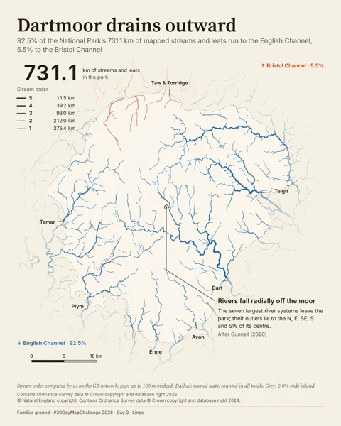
The Wheel
Dartmoor · Lines · 3 maps, film
- 03
 Posted
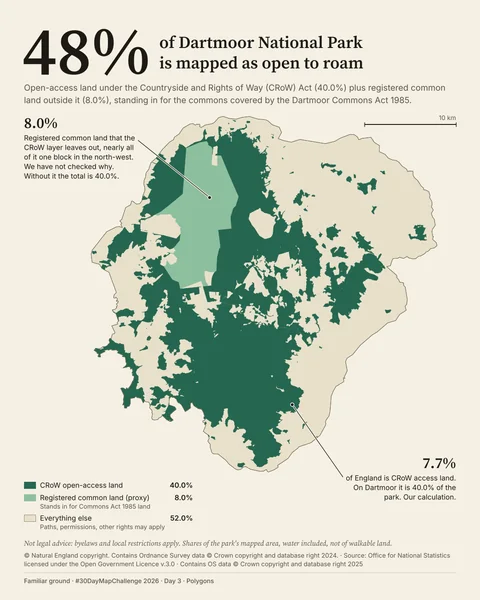
Where you may roam
Dartmoor · Polygons · 3 maps, film
- 04
 Posted
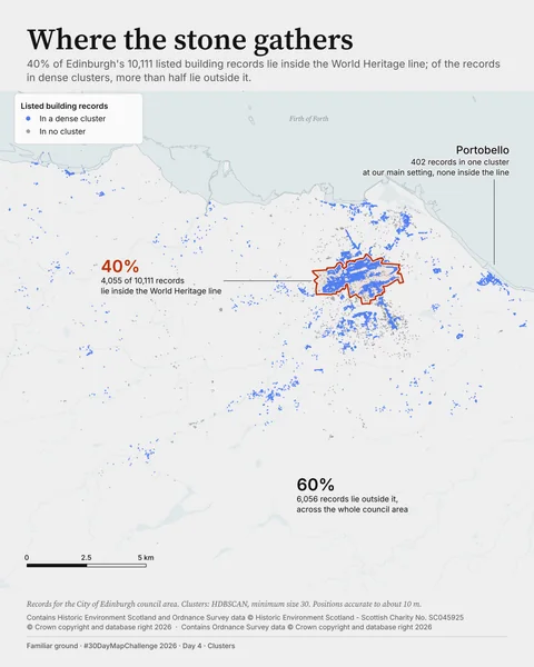
Where the stone gathers
Edinburgh · Clusters · 4 maps
- 05
 Posted
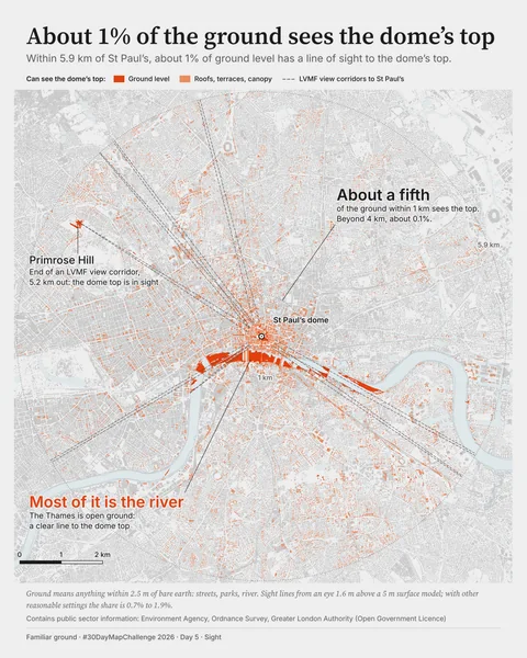
St Paul's dome viewshed
London · Sight · 1 map
- 06
 Posted
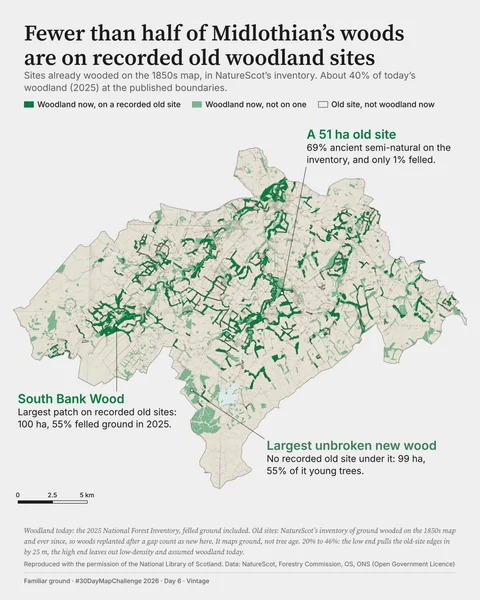
Fewer than half of Midlothian's woods are on recorded old woodland sites
Midlothian · Vintage · 1 map
- 07
 Posted
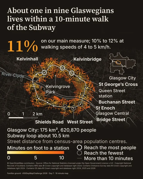
About one in nine Glaswegians lives within a 10-minute walk of the Subway
Glasgow · 10 minute map · 2 maps
- 08
 Posted
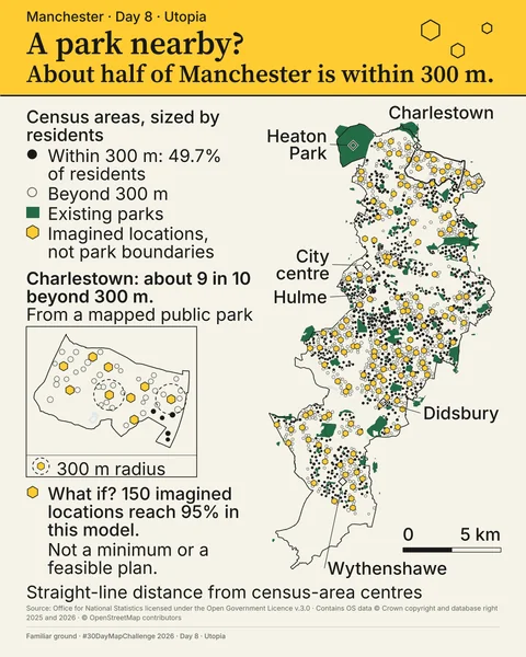
About half of Manchester lives within 300 m of a mapped park
Manchester · Utopia · 1 map
- 09
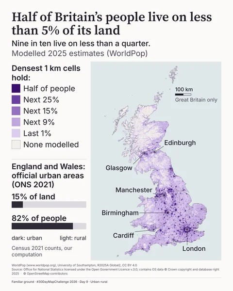 Posted
Half of Britain's people live on less than 5% of its land
Great Britain · Urban-rural · 1 map, 2 films
- 10
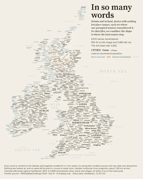 Posted
In so many words
Britain and Ireland · Prompting only · 1 map