Dartmoor by starlight
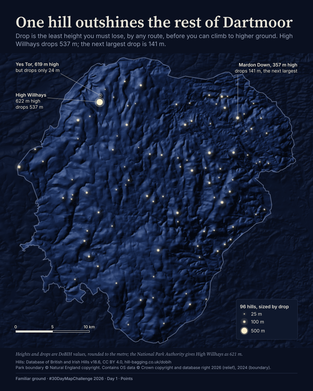
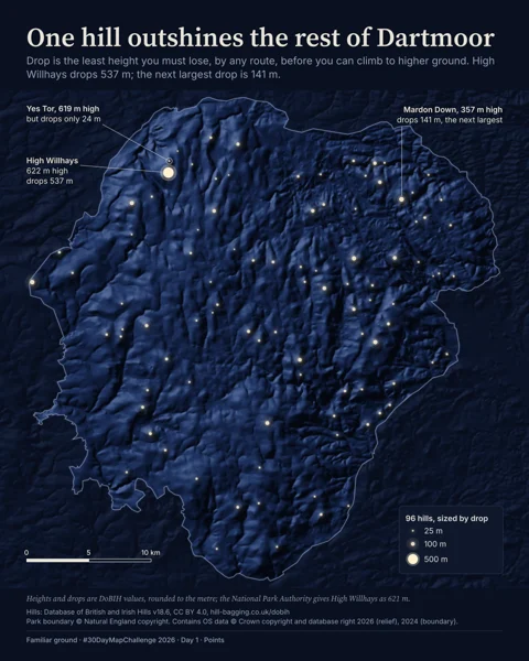
96 hills, drawn as stars. One measure of a hill tells a very different story from its height.
Database of British and Irish Hills (CC BY 4.0); Natural England, Ordnance Survey (OGL v3.0)
View full-size BFamiliar ground / Contact sheet
Working versions, not a finished portfolio. Filter by theme or place, then open a plate to see what changed.
96 hills, drawn as stars. One measure of a hill tells a very different story from its height.
Database of British and Irish Hills (CC BY 4.0); Natural England, Ordnance Survey (OGL v3.0)
View full-size B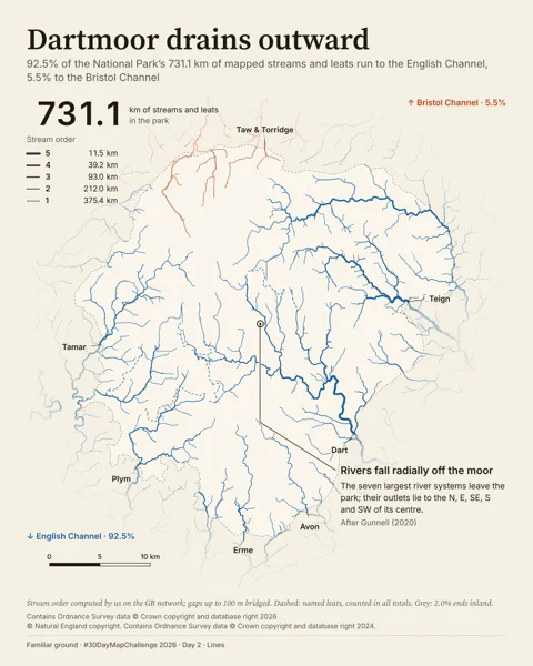
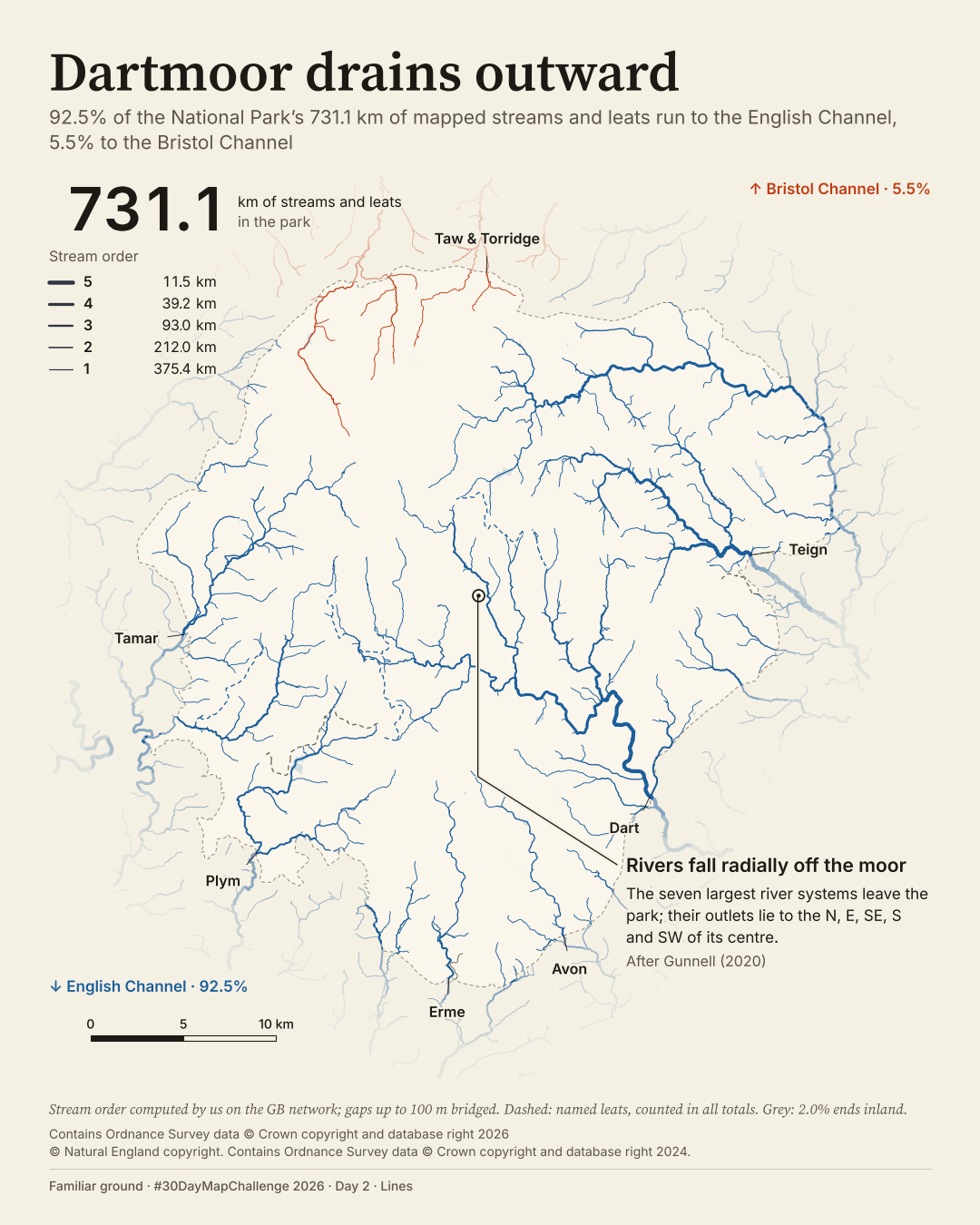
A river network that falls away in every direction, but mostly reaches the same sea.
Ordnance Survey, Natural England (OGL v3.0)
View full-size B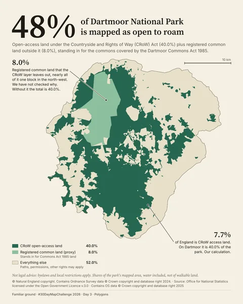
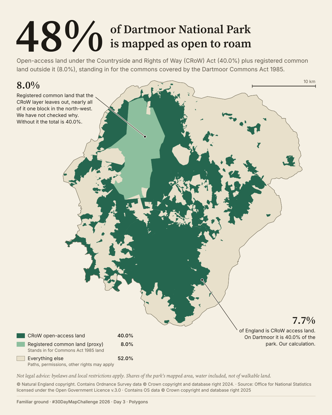
48% of the park's mapped area, with an important distinction between the two layers.
Natural England, ONS, Ordnance Survey (OGL v3.0); National Trust (CC BY 4.0)
View full-size B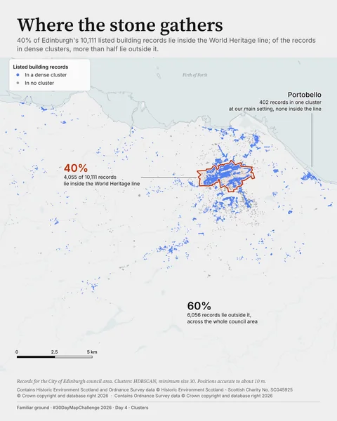
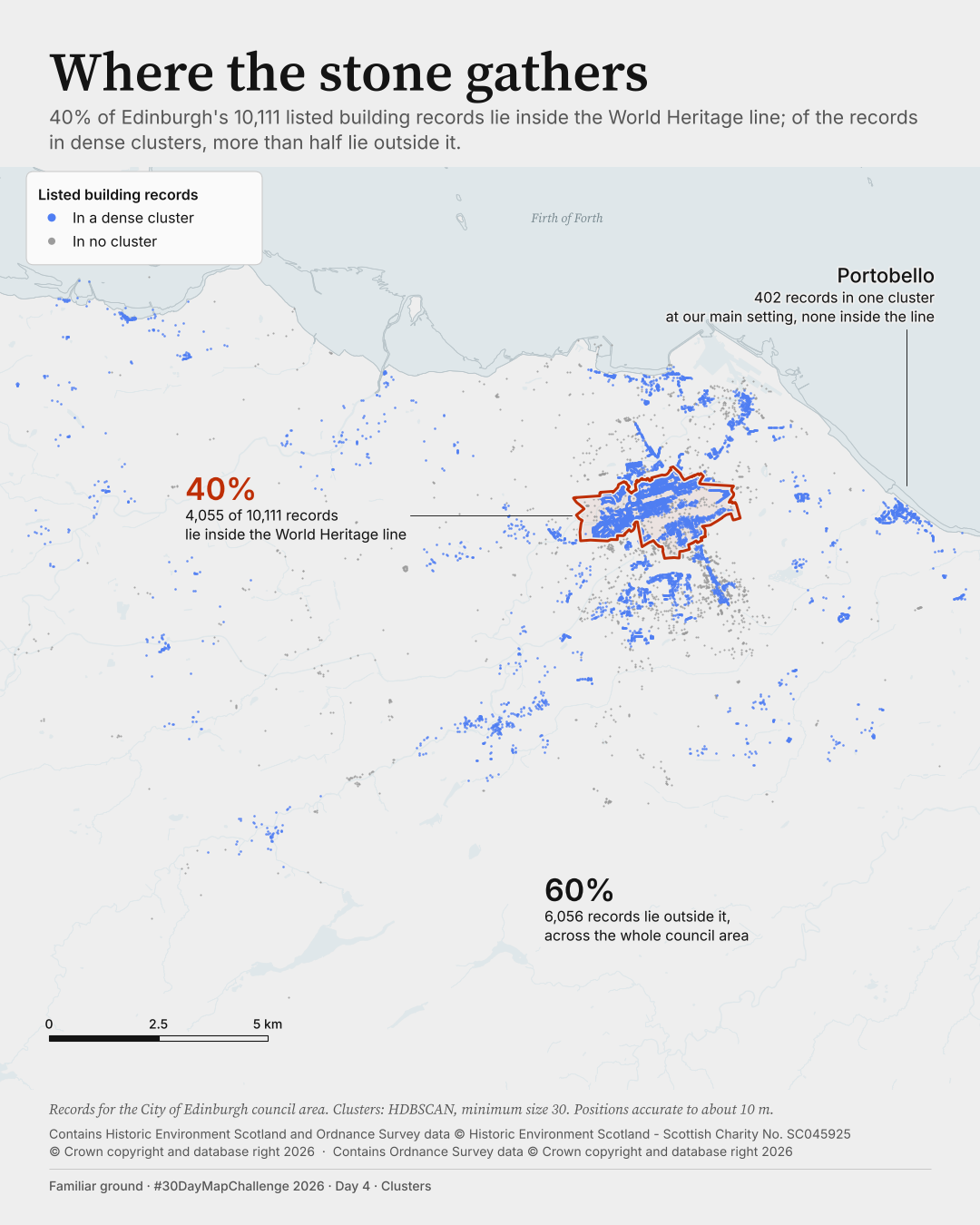
The heritage line encloses 40% of records. Most records in dense clusters lie outside it.
Historic Environment Scotland, Ordnance Survey
View full-size B3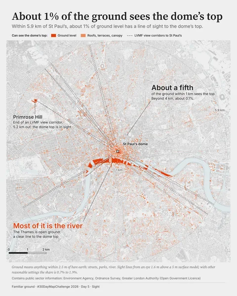
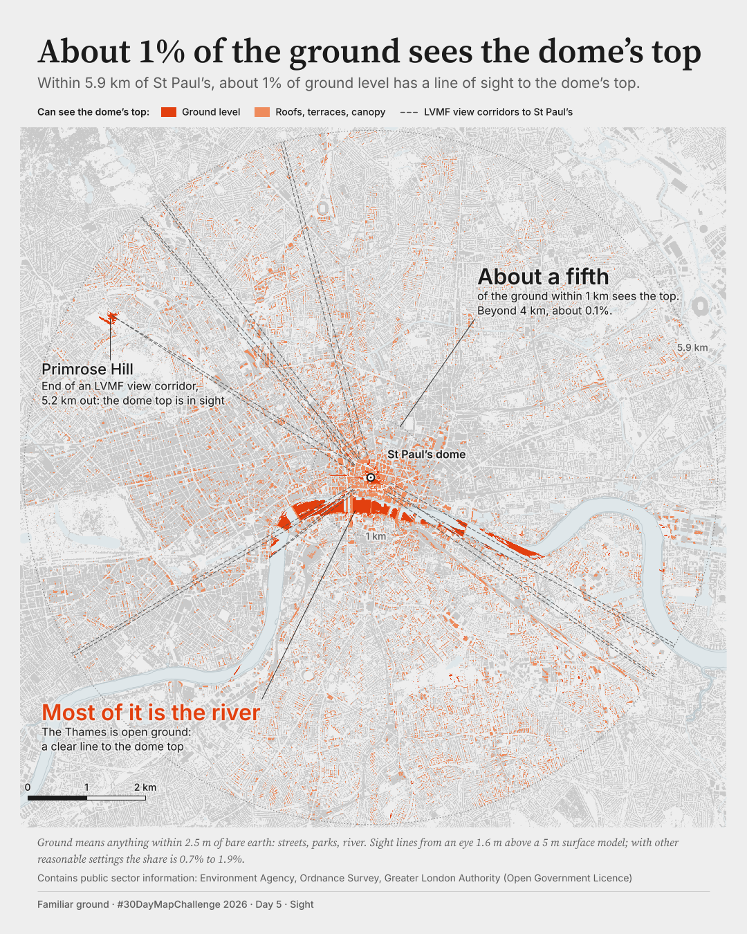
Within 5.9 km of the dome, about 1% of ground level has a clear line of sight to its top. Most of that ground is the Thames.
Environment Agency, Ordnance Survey, Greater London Authority (Open Government Licence)
View full-size A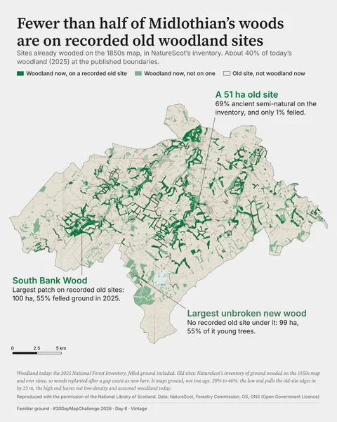
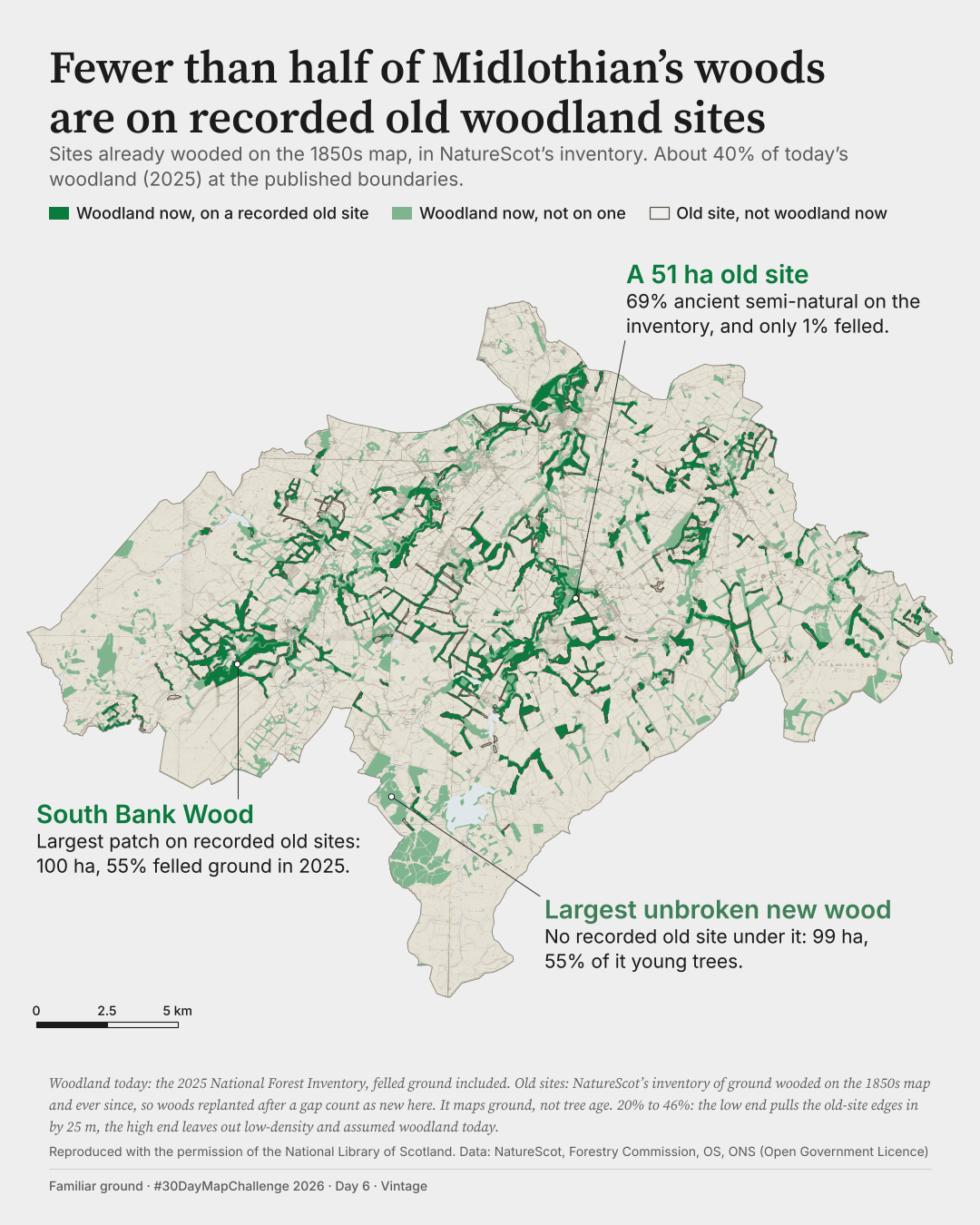
About 40% of today's woodland area lies on recorded old woodland sites at the published boundaries. Depending on the edges and definitions the share runs from 20% to 46%; every case is under half.
National Library of Scotland; NatureScot, Forestry Commission, ONS, Ordnance Survey (OGL v3.0)
View full-size A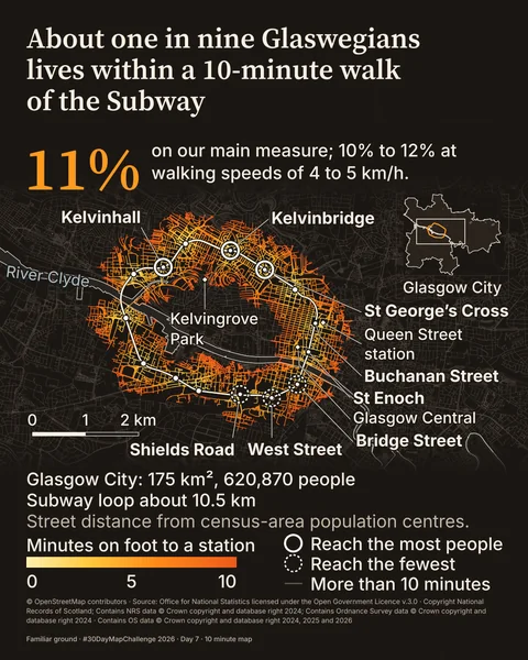
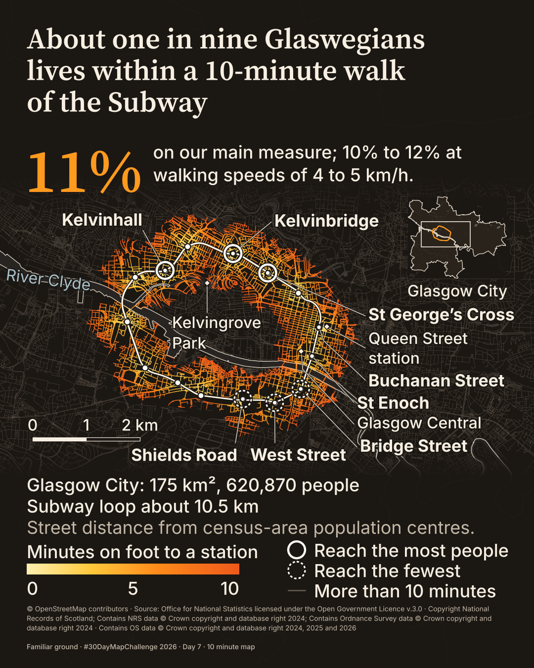
Two maps for one prompt: the parks recorded in OS Open Greenspace, drawn in about a minute, and a walk-shed of the 15-station Subway loop.
OpenStreetMap contributors; National Records of Scotland, ONS, Ordnance Survey
View full-size B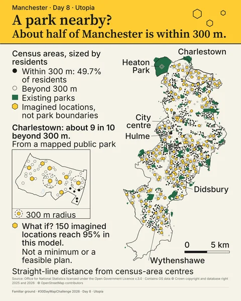
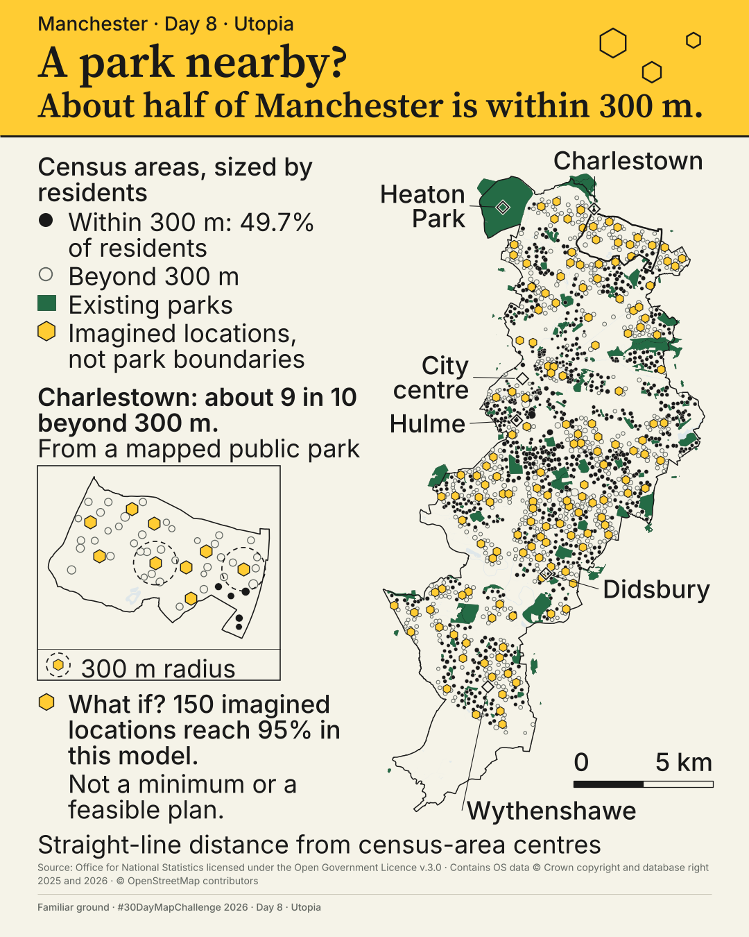
A big park and a nearby park are not the same thing. About half of Manchester is within 300 m of a mapped park. In Charlestown, roughly 9 in 10 residents are not.
Ordnance Survey, ONS (OGL v3.0); OpenStreetMap contributors; Konijnendijk (2023)
View full-size A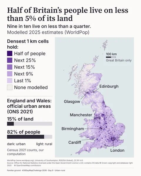
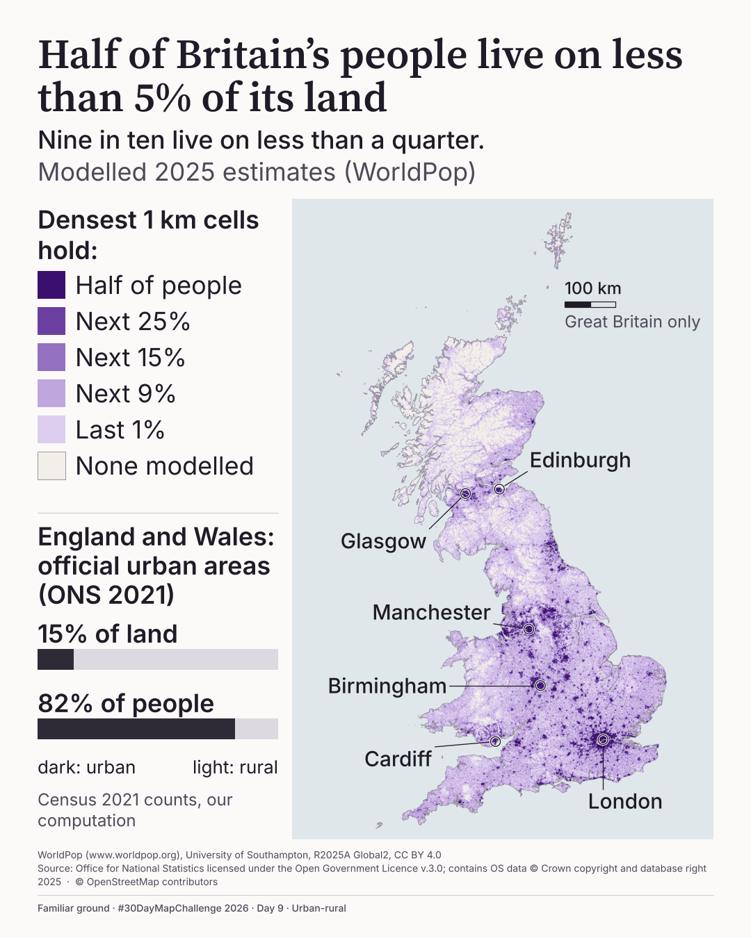
Every 1 km square in Great Britain, shaded by modelled 2025 population density. Half the people live on less than 5% of the land.
WorldPop (CC BY 4.0); ONS and OS (OGL v3.0); OpenStreetMap contributors
View full-size A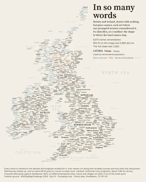
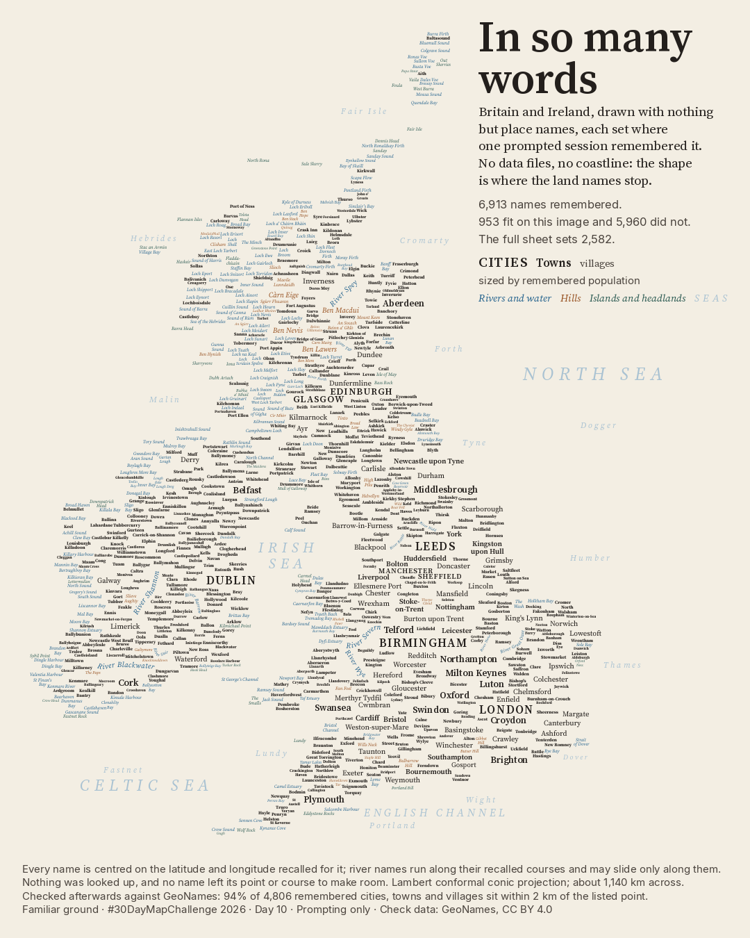
Britain and Ireland made of place names alone, recalled in one prompted command-line session and checked only afterwards.
Checked against GeoNames and DoBIH (CC BY 4.0); © OpenStreetMap contributors (ODbL)
View full-size ANo maps match both filters. Try another theme or place.