Day 10 / Prompting only / Britain and Ireland
In so many words
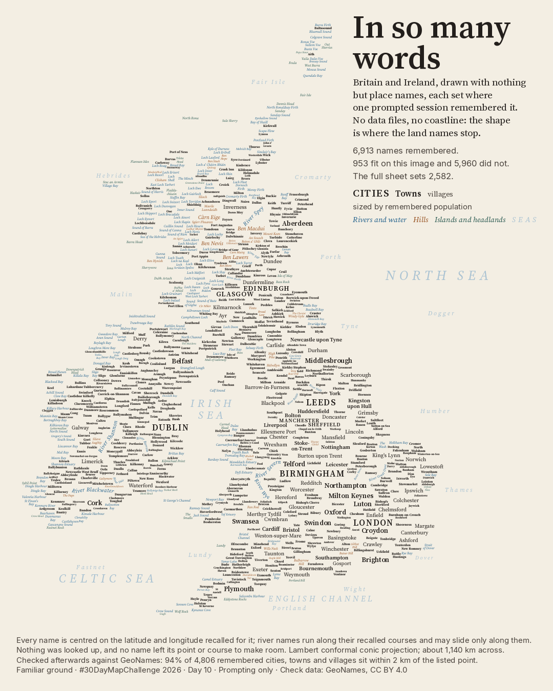
The islands appear where the land names stop.
What shape do the islands take when a language model recalls their names?
Posted on LinkedIn: A ·
 Enlarge
Credits: Checked against GeoNames and DoBIH (CC BY 4.0); © OpenStreetMap contributors (ODbL). Full sources
6,913
names recalled in one prompted session
953
names set on this image
94%
of 4,806 recalled settlements within 2 km of the GeoNames point
The thinking
What I tried and why
Fable 5.2, a language model, recalled the names and positions in one prompted command-line session, working from what it had learned, with no supplied data files and no network access. No coastline was drawn: the land takes shape through the names alone.
The session wrote down 6,913 names; 953 fit on this image and 4,067 on the largest sheet. Rivers follow their recalled courses. This is a drawing of what the model chose to remember, not a complete gazetteer.
Method
How it was made
The recalled names and positions were frozen before reference data were fetched for checking. Names were matched to compatible kinds of place in GeoNames; distances were geodesic on WGS84. With every unmatched settlement counted as a miss, 94% of all 4,806 recalled cities, towns and villages sit within 2 km of the listed point. The session recalled 430 of the 500 largest places GeoNames lists for these islands; 29 of the 70 missed are parts of London. Of 514 summit heights checked against the Database of British and Irish Hills, 61% are within half a metre.
Limits
What this cannot tell you
The session was asked to keep only places it was confident of, so accuracy on its self-chosen list is not completeness. Gazetteers such as GeoNames are the kind of source a language model learned from: agreement with the gazetteer is not a survey of the ground or an independent test of knowledge. The labels are too small to read individually at phone size; enlarge the image to explore them.
Next
What I’d do next
I would compare omissions as carefully as positions, rather than let a recognisable outline stand in for completeness.
Read my learning logData and credits
Sources
Names and coordinates were generated from recall; reference data were used afterwards for checks, not to draw the map.
- Settlement checks · GeoNames
- GeoNames (geonames.org), CC BY 4.0CC BY 4.0
- Summit checks · Database of British and Irish Hills
- The Database of British and Irish Hills v18.6, CC BY 4.0CC BY 4.0
- River and name checks · OpenStreetMap
- © OpenStreetMap contributors, ODbLOpen Database Licence 1.0
My map design and text: Creative Commons Attribution 4.0 (CC BY 4.0). Source data retain the licences above. Every source across the series is on the credits page.