Day 15 / Inside out / Washington, D.C.
D.C., inside out
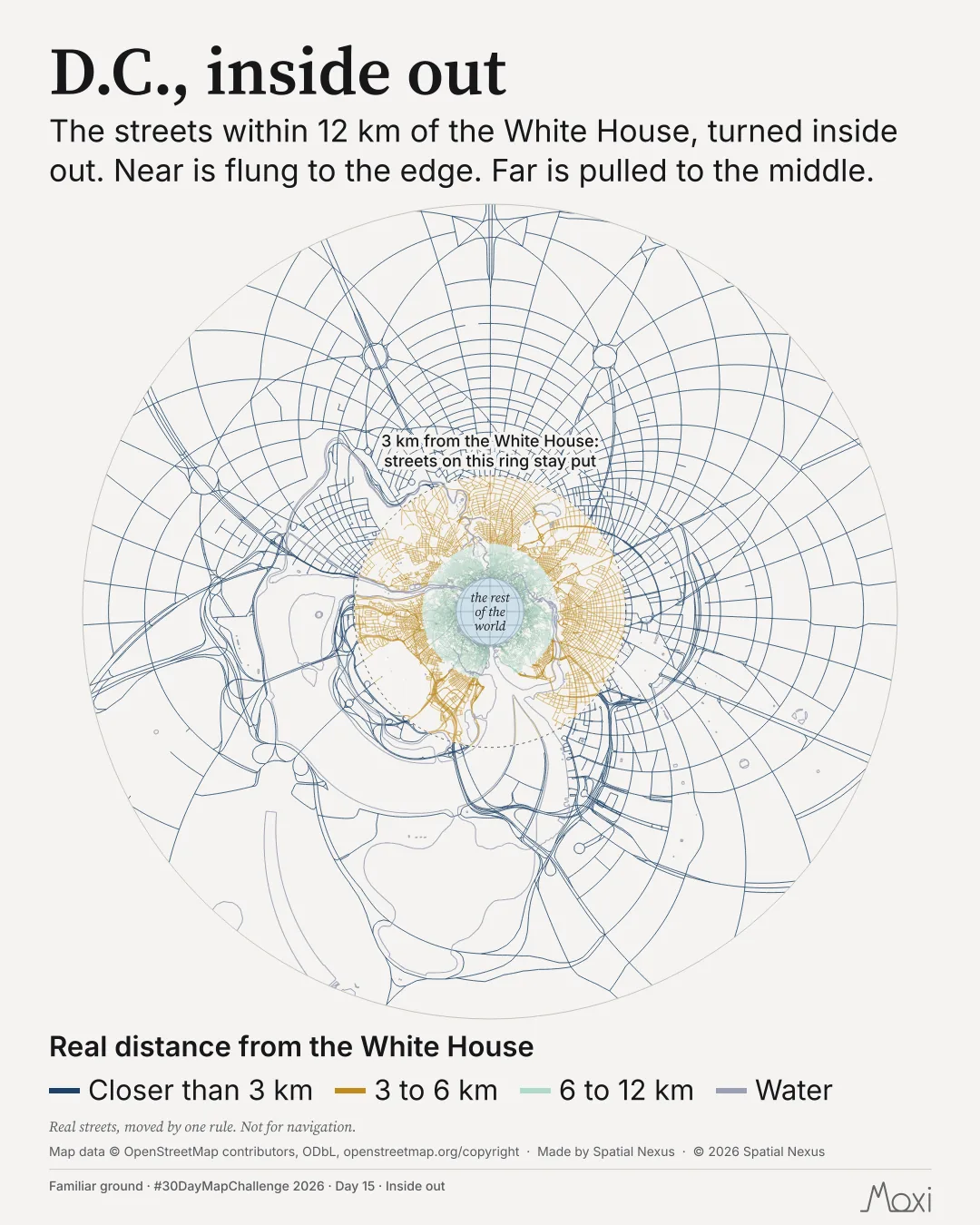
The streets within 12 km of the White House, turned inside out. Near is flung to the edge. Far is pulled to the middle.
Posted on LinkedIn on .
 Enlarge
Credits: Map data © OpenStreetMap contributors, ODbL. Full sources
The thinking
What I tried and why
Real streets, moved by one rule. Not for navigation.
A dashed ring marks 3 km from the White House, where streets stay put. Streets closer to the centre move out. Streets beyond the ring move in. The interactive lets you move the centre and change the ring.
Method
How it was made
The map uses circle inversion. A point at distance r from the centre moves to distance R²/r on the same bearing, where R is the ring radius. The ring stays put. The streets are coloured by their real distance from the centre.
Limits
What this cannot tell you
This is a transformation of real street geometry, not a route map. The view contains streets within 12 km of the White House. It is not for navigation.
Next
What I’d do next
Try another centre and ring in the interactive, then switch to “As on the ground” to compare.
Read my learning logData and credits
Sources
Street geometry is moved by circle inversion. The colours refer to real distance, not distance on the transformed page.
- Map data
- © OpenStreetMap contributors. OpenStreetMap data, November 2026.Open Database Licence (ODbL)
Map design and text © 2026 Spatial Nexus. All rights reserved. Source data retain the licences above. Every source across the series is on the credits page.