Day 14 / Borgesian map / Sumas Prairie
The lake that came back, for a few weeks.
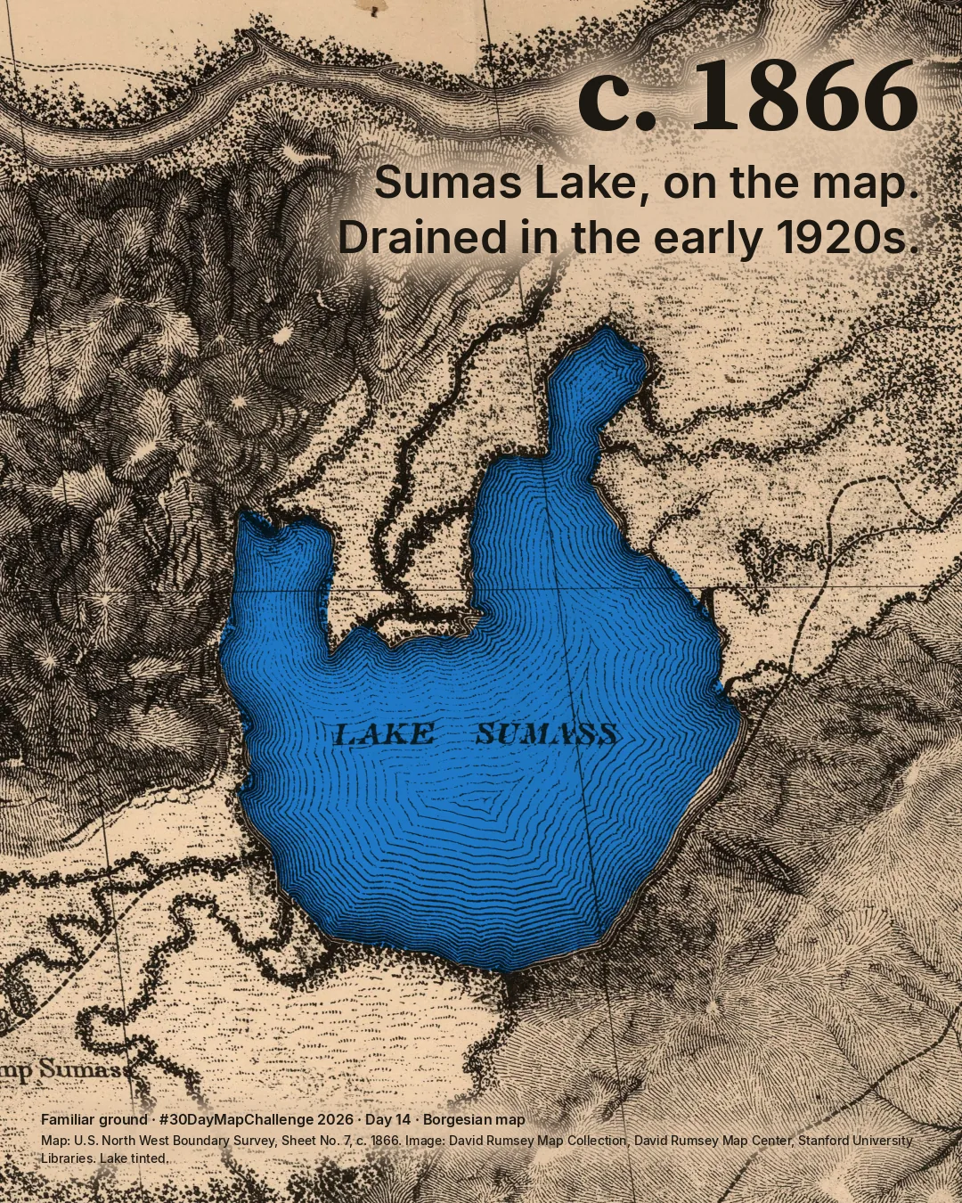
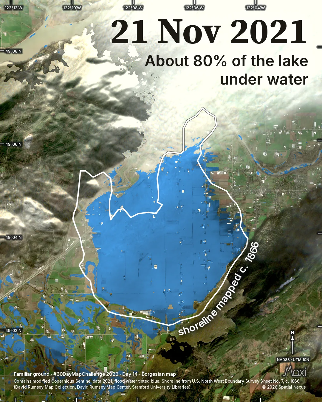
Sumas Lake was drained in the early 1920s. On 21 November 2021 about 80% of the lake, as a survey map of c. 1866 shows it, was under flood water.
Posted on LinkedIn on , the version shown here.
 Enlarge
Credits: Map image: David Rumsey Map Collection · Contains modified Copernicus Sentinel data 2021. Full sources
The thinking
What changed and why
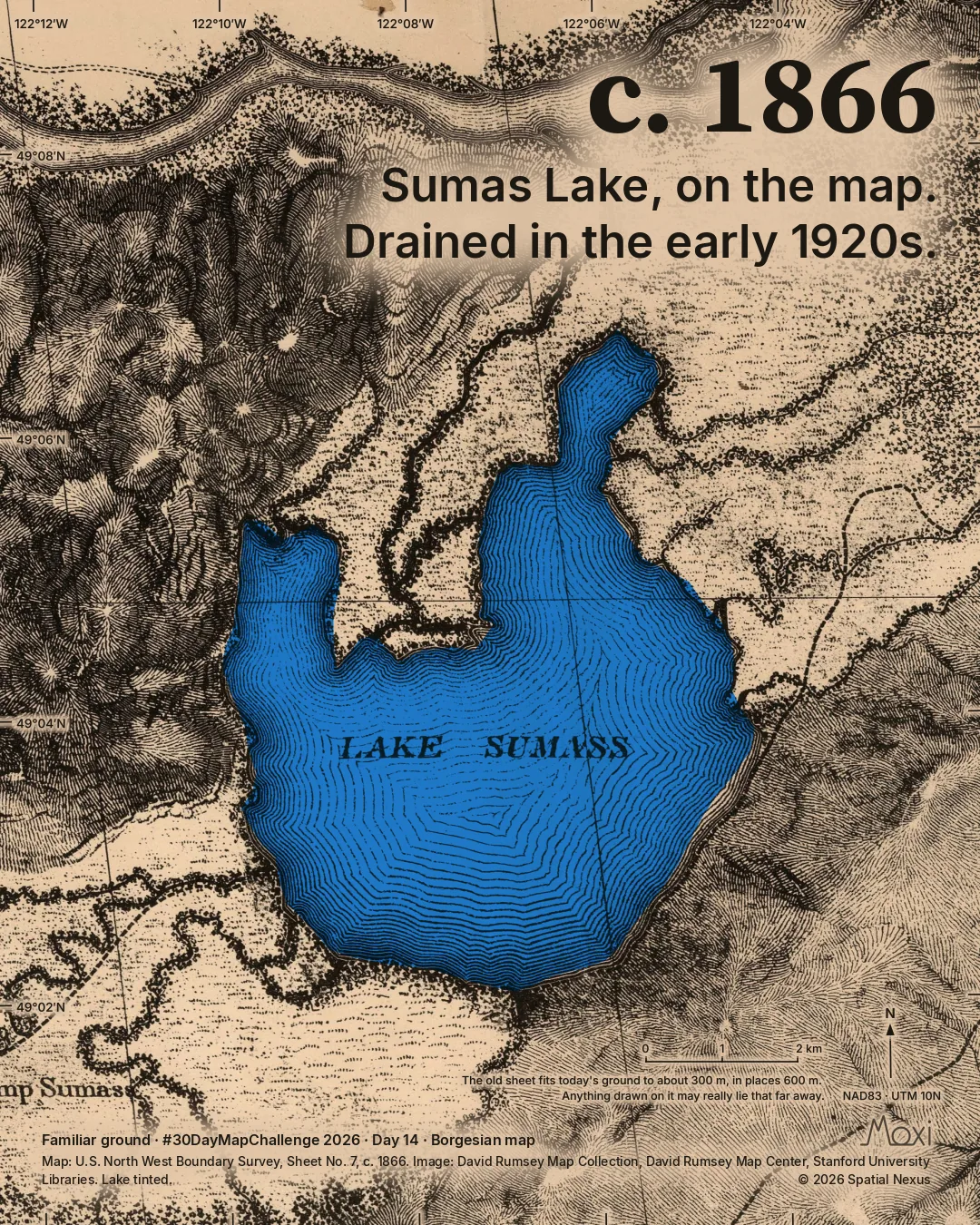
I started from a survey map printed about 1866. On it, Sumas Lake lies where Sumas Prairie is today, in Abbotsford, British Columbia. The lake was drained in the early 1920s to make farmland, and for about a century it survived mainly on old maps and in memory. It lay in the traditional territory of the Semá:th people. Sumas First Nation calls it Semá:th Xó:tsa.
For the people who live and farm there it was a disaster. More than 3,300 people in Abbotsford were told to leave their homes, and the prairie flooded again in December 2025. The map shows where the water lay on one day. It says nothing about what should happen next.
The posted pair is shown first. The formal pair adds a north arrow and coordinates.
Two frames, two versions
The lake and the flood
Gallery · posted pair
Enlarge 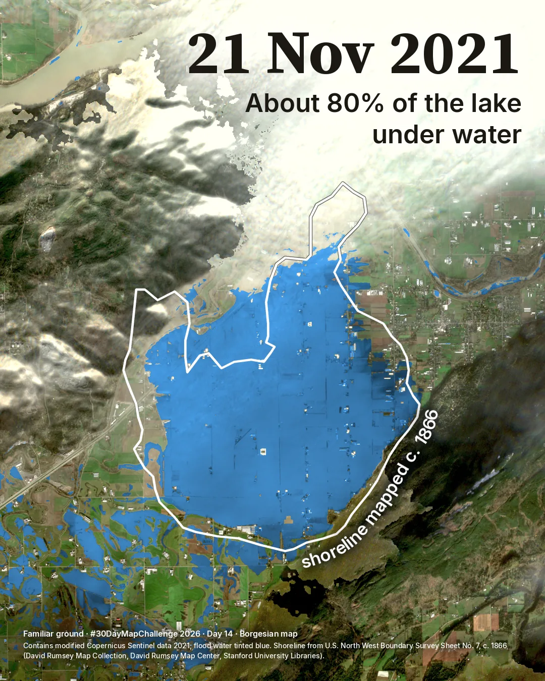
Story · formal pair
 Enlarge
Method
How it was made
The survey sheet was fitted to today’s ground on 14 points that have not moved. Its engraved edge of open water was laid over a Sentinel-2 photograph of 21 November 2021. Where cloud hides the ground it is left unpainted. Water under cloud, seen by Sentinel-1 radar, is counted in the number but not shown.
Limits
What this cannot tell you
This is a low-water lake outline surveyed some 60 years before it was drained, not a 1920s shoreline. The fit is good to about 300 m, except the north-west arm, which is up to 600 m out. The photograph is three to four days after the largest flood extent. About 80% is a rounded finding, not a precise second digit.
Next
What I’d do next
A shoreline closer to the time of draining would offer a different comparison. No 1920s shoreline could be obtained for this map.
Read my learning logData and credits
Sources
The scan was fitted to the ground. The flood water is tinted blue. The scan keeps the collection’s own terms; the drawing and text are © 2026 Spatial Nexus, all rights reserved.
- Map image
- David Rumsey Map Collection, David Rumsey Map Center, Stanford University Libraries (list no. 2889.007).Credit required; no facsimiles for sale
- Satellite
- Contains modified Copernicus Sentinel data 2021.Copernicus Sentinel data terms
- Sentinel-1 radar
- RTC product processed by Catalyst, via Microsoft Planetary Computer.CC BY 4.0
- Flood maps used as a check
- Natural Resources Canada, Emergency Geomatics Service; contains information licensed under the Open Government Licence - Canada.Open Government Licence - Canada
- Elevation used in the analysis
- produced using Copernicus WorldDEM-30 © DLR e.V. 2010-2014 and © Airbus Defence and Space GmbH 2014-2018 provided under COPERNICUS by the European Union and ESA; all rights reserved.Copernicus DEM licence
Map design and text © 2026 Spatial Nexus. All rights reserved. Source data retain the licences above. Every source across the series is on the credits page.