Day 03 / Polygons / Dartmoor
Where you may roam
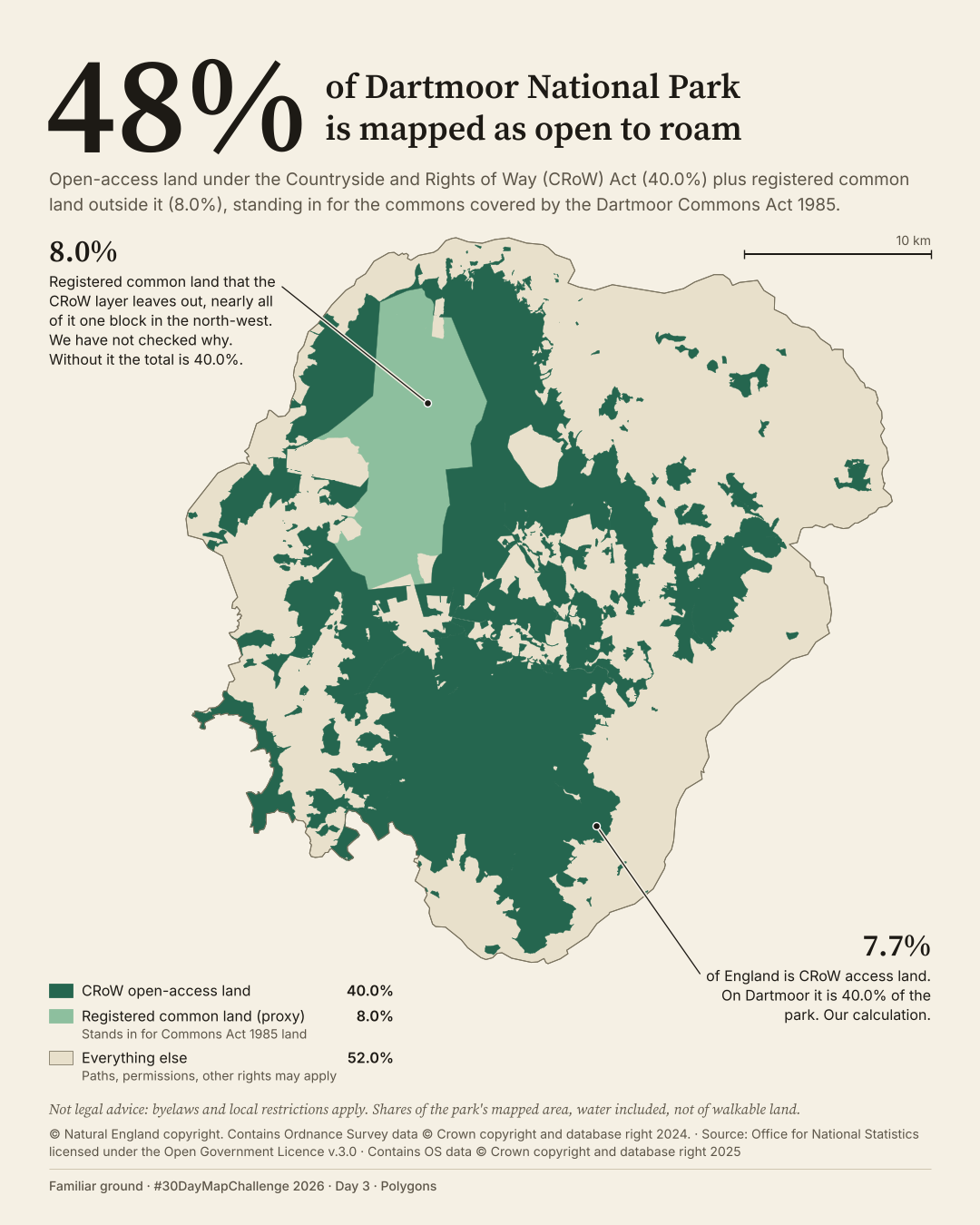
How much of Dartmoor is mapped as open-access land or registered common land?
 Enlarge
Credits: Natural England, ONS, Ordnance Survey (OGL v3.0); National Trust (CC BY 4.0). Full sources
48%
of the park is CRoW access land or registered common land
40.0%
is CRoW access land; registered common land outside it adds 8.0%
The thinking
What changed and why
I moved 48% from a side panel into the headline. The number is the reason for the map.
I used one green family for the two open-land layers on a paper ground. I removed the camping outline, water and separate National Trust class from B because they did not explain that total.
I kept two callouts: the CRoW comparison with England, and the 8.0% of registered common land outside that layer. That common land is a proxy for land covered by the Dartmoor Commons Act 1985, not a map of the Act itself.
Before / after
A second look
Same canvas, different decisions. Drag the divider, or focus the slider and use the arrow keys. This compares layouts, not perfectly registered geography.
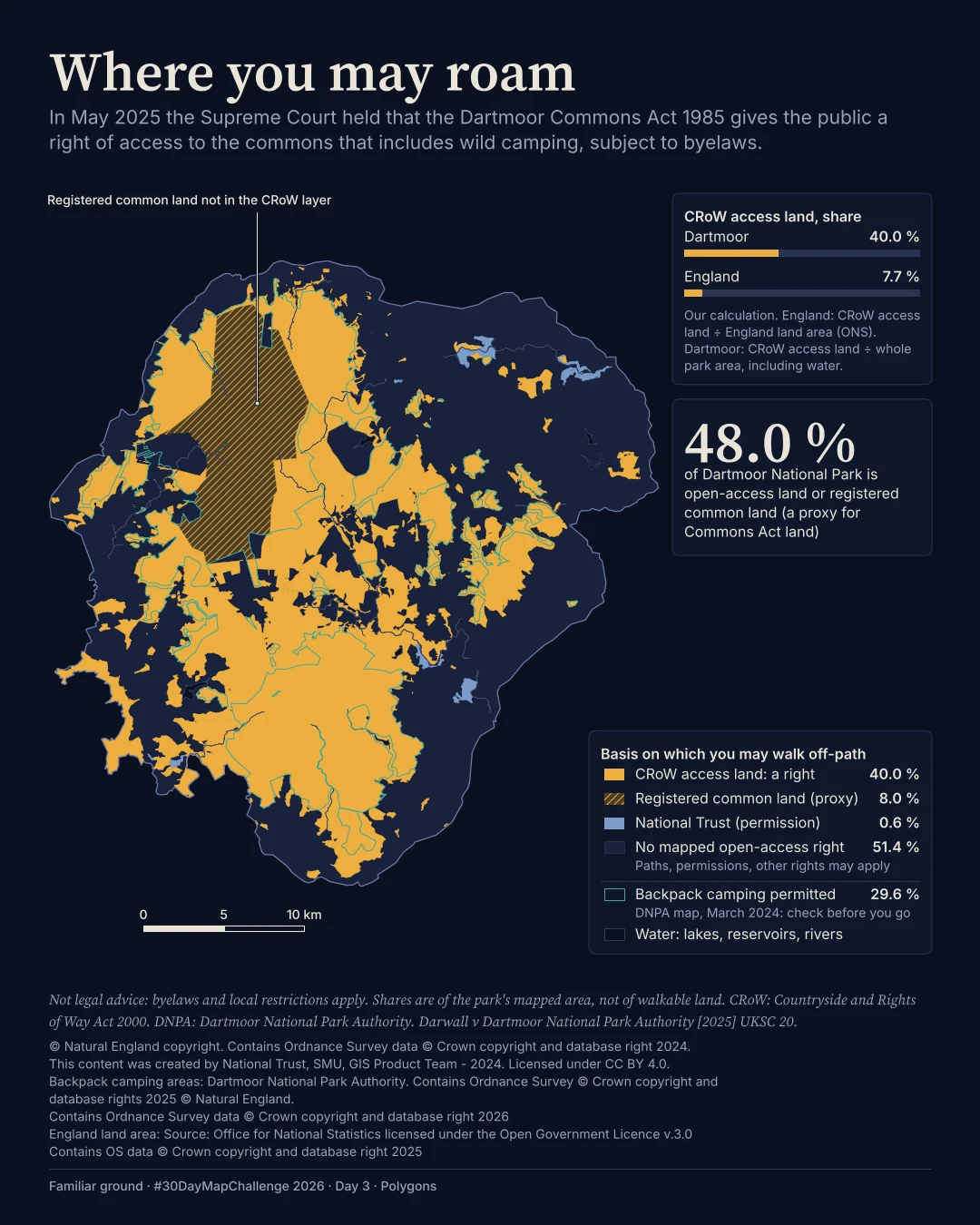
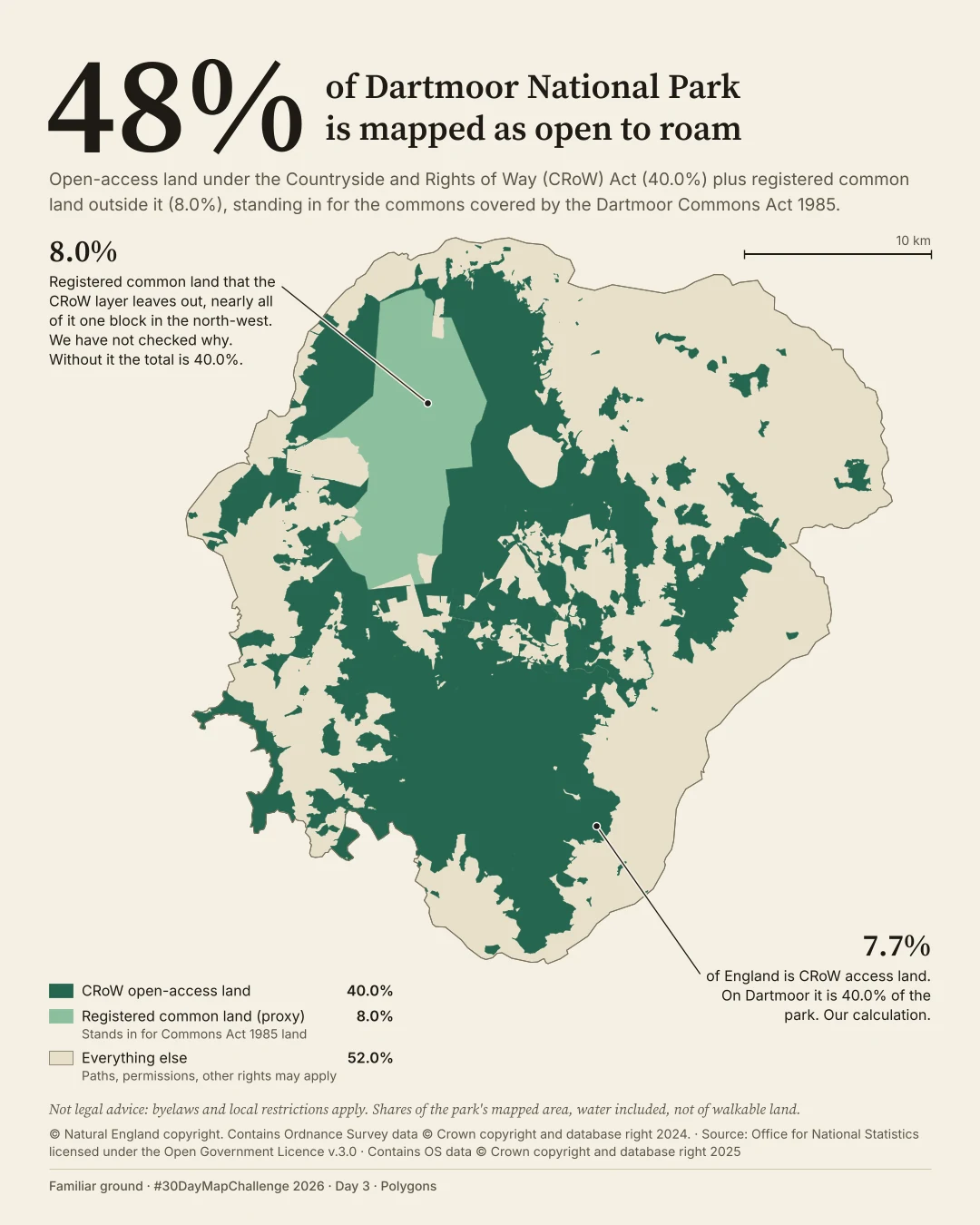
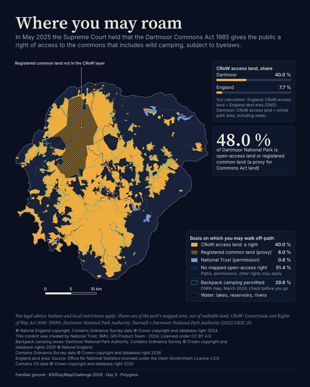
Plate 03 in motion
The film
BThe map in motion
I kept two callouts: the CRoW comparison with England, and the 8.0% of registered common land outside that layer. That common land is a proxy for land covered by the Dartmoor Commons Act 1985, not a map of the Act itself.
Text description of this film
A light map of Dartmoor with a large 48% headline. Two greens distinguish CRoW open-access land, 40.0% of the park, and registered common land outside that layer, 8.0%, mostly one north-west block. Callouts compare Dartmoor's CRoW share with England's 7.7% and explain why the common-land layer matters.
Method
How it was made
I clipped and overlaid the access and common-land polygons inside the park, avoiding double counting. The CRoW layer covers 40.0% and registered common land outside it adds 8.0%. The National Trust layer was used in the underlying calculation but is not drawn separately in B.
Limits
What this cannot tell you
These shares use the park's mapped area, including water, not walkable land. Registered common land is a proxy, not a verified legal boundary for the 1985 Act. This is not legal advice or a navigation map; byelaws and local restrictions apply.
Next
What I’d do next
I would settle the legal-plan sources and reuse rights before choosing the layers, keep a short list of allowed claims beside the map, and resolve the denominator's attribution questions at the start rather than at credit time.
Read my learning logData and credits
Sources
I filtered, clipped and re-symbolised the source polygons. The camping outline in A is from the National Park Authority; its source and reuse caveat are noted below.
- CRoW access land, registered common land and park boundary
- © Natural England copyright. Contains Ordnance Survey data © Crown copyright and database right 2024.Open Government Licence v3.0
- England land area for the comparison
- Source: Office for National Statistics licensed under the Open Government Licence v.3.0 Contains OS data © Crown copyright and database right 2025Open Government Licence v3.0
- National Trust land · underlying calculation
- This content was created by National Trust, SMU, GIS Product Team - 2024. Licensed under CC BY 4.0.CC BY 4.0
- OS VectorMap District water · A only
- Contains Ordnance Survey data © Crown copyright and database right 2026Open Government Licence v3.0
The A method records two source licence statements for the Dartmoor National Park Authority camping layer: data.gov.uk says UK Open Government Licence; ArcGIS says “No restriction on the use of this data”. It does not spell out the full camping credit string, so I have not invented one here. The original image retains its credit. The ONS year is inferred from the item vintage; I have retained the method's string rather than silently changing it.
My map design and text: Creative Commons Attribution 4.0 (CC BY 4.0). Source data retain the licences above. Every source across the series is on the credits page.